Picture this: you’re cruising on open water, wind in your hair, when a red triangle buoy suddenly appears ahead. Do you veer left or right? One wrong turn could ground you on a sandbar—or worse. Buoys and markers are the unsung traffic signs of waterways, and mastering them is non-negotiable for safe boating.
The Two Main Systems
Most U.S. inland and coastal waters follow the U.S. Aids to Navigation System (ATON):
- Lateral markers show the edges of safe channels (think “road lines”).
- Non-lateral markers convey hazards, information, or restrictions.
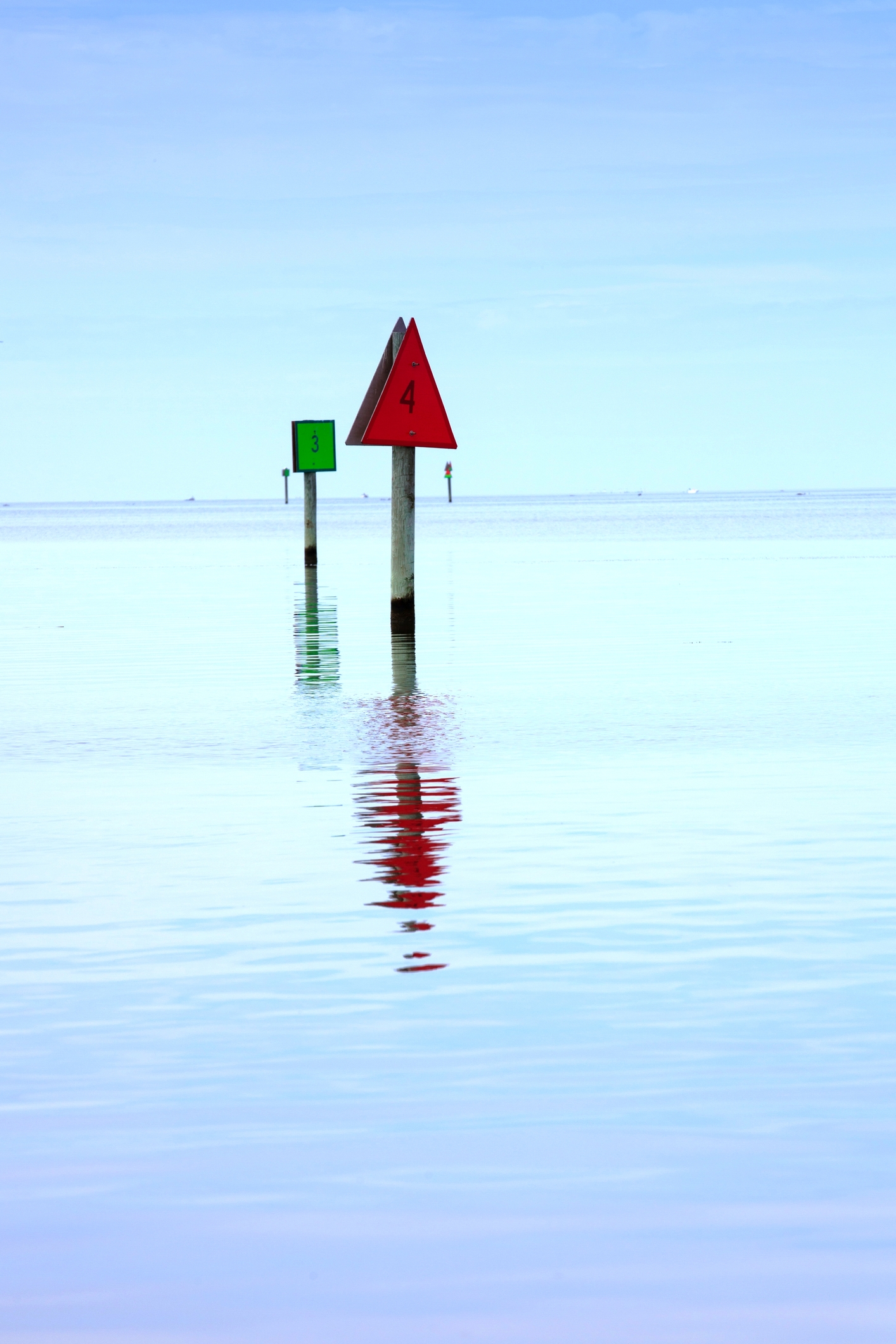
A quick mnemonic for lateral markers when returning from the sea (heading upstream): “Red Right Returning.” Keep red markers to your starboard (right) side.
Lateral Markers Demystified
| Shape/Color | Meaning When Returning |
|---|---|
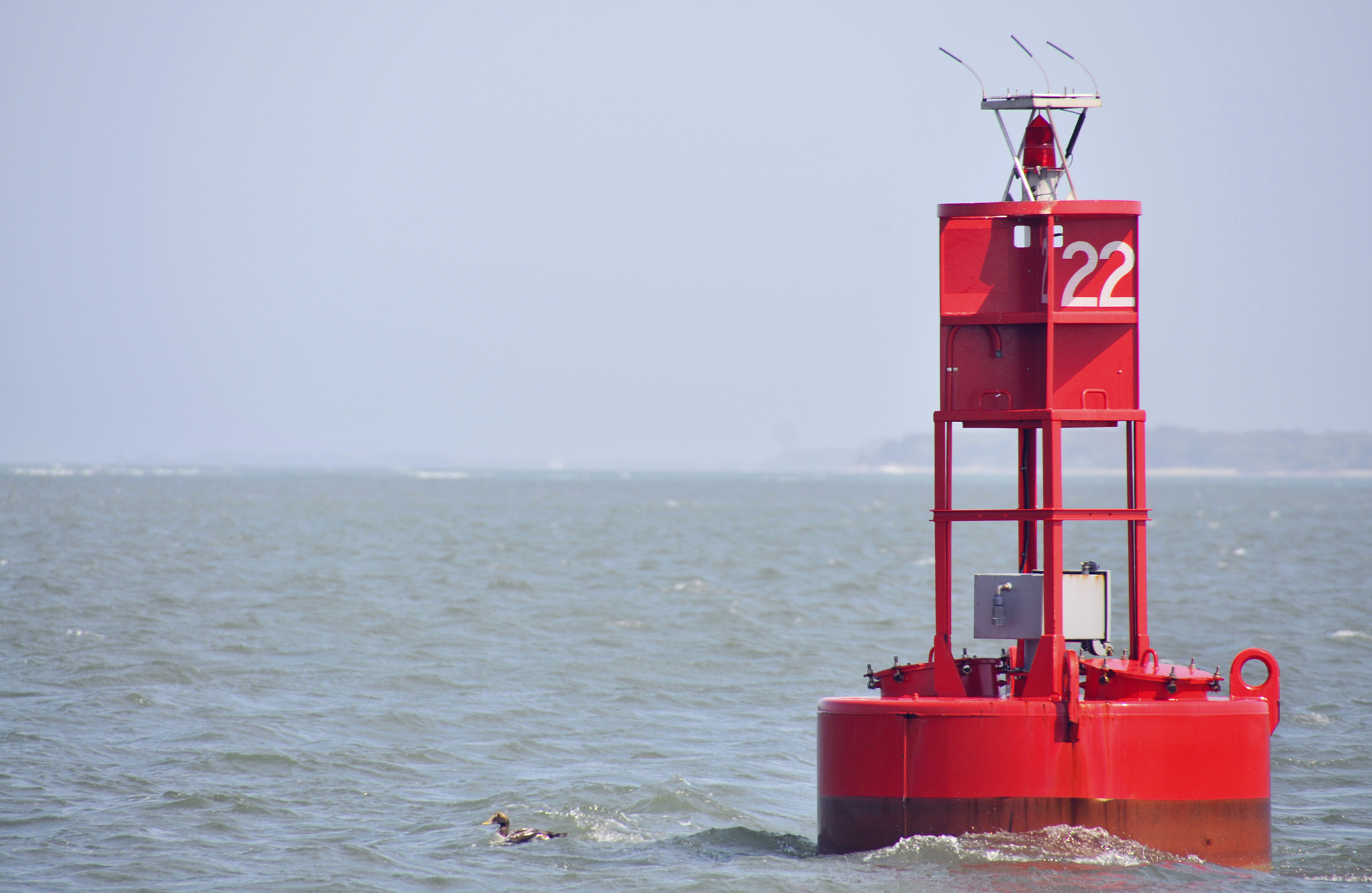
| Red triangle (nun buoy) | Marks starboard side of channel |
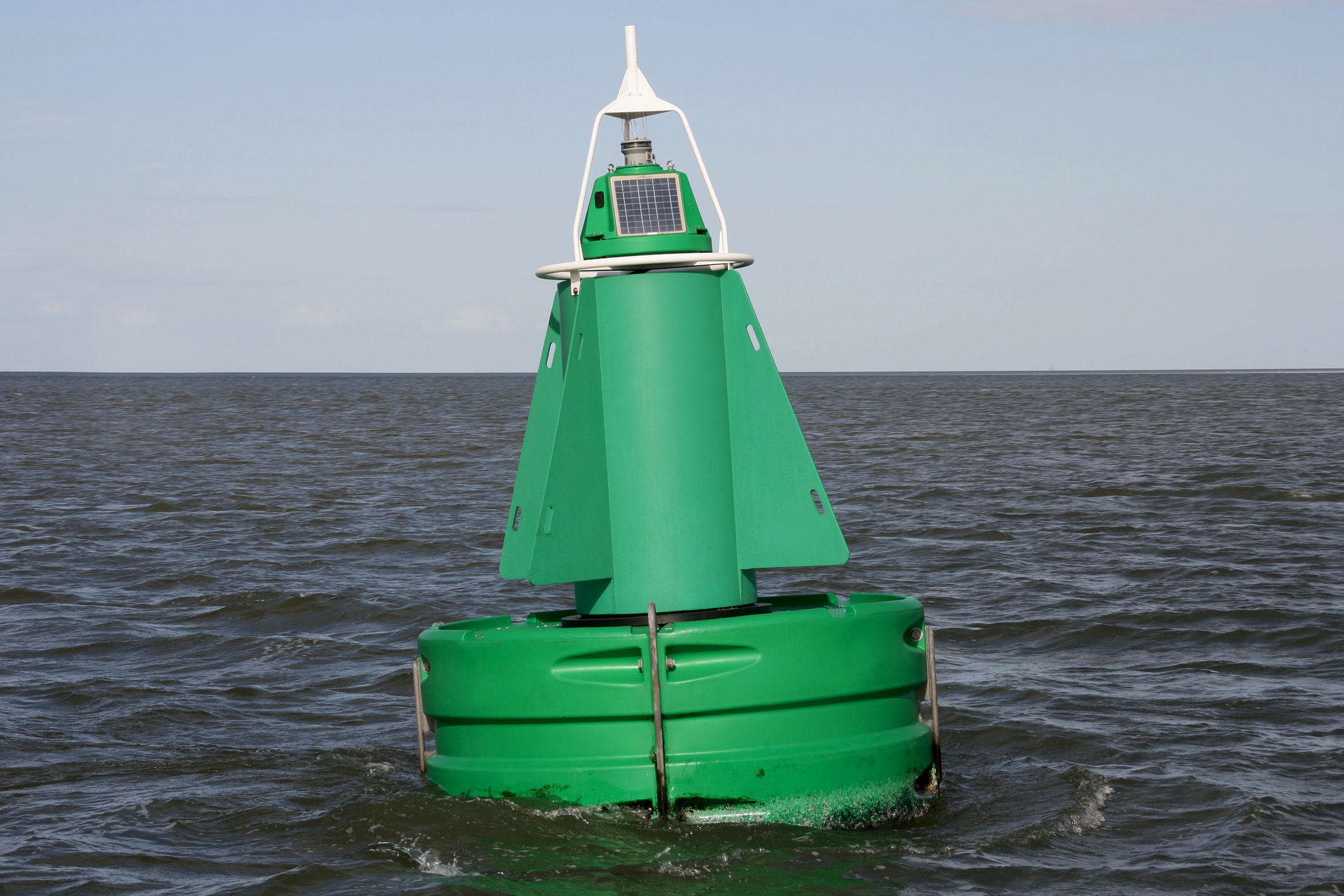
| Green can | Marks port side of channel |
Non-Lateral Markers You Can’t Ignore
- Yellow = Special purpose (fishing zones, pipelines). Treat as informational.
- White with orange bands = Regulatory:
- Diamond = Danger
- Circle = Controlled area (speed/no-wake)
- Crossed diamond = Boats keep out
- Square = Info (marina, fuel)
- Red-and-white vertical stripes = Safe water all around (fairway or mid-channel).
- White with black vertical stripes = Inland obstruction—do not pass between it and shore.
Lights and Quick-Reference at Night
- Red or green flashing = lateral marker (same side rules apply).
- White flashing every 4 seconds = safe-water mark.
- Carry the free USCG Light List or use apps like Navionics for real-time shapes and light patterns.
Buoys aren’t decorations—they’re your lifeline. Take five minutes to study them before every trip, and you’ll glide through channels with confidence. Safe boating starts with knowing the signs.